Drone based Hyperspectral Imaging for precision agriculture:
India has been traditionally dependent on agriculture. However, while around 60–70% of Indian population (directly or indirectly) depends upon Agriculture sector but currently it contributes to only 16–17% of the GDP. Studies have shown that one of the main reasons for such a low productivity in agriculture sector being that it has been largely a traditional farming.
To address low yield due to traditional farming, Nihon Communication Solutions Pvt. Ltd.(NCS) is proposing a revolutionary method, wherein the farm lands are characterized using Hyperspectral imaging and then using well known techniques, the land characterization can be used for precision agriculture, resulting in high yield, optimized farming, accurate predictability and consistency in production.
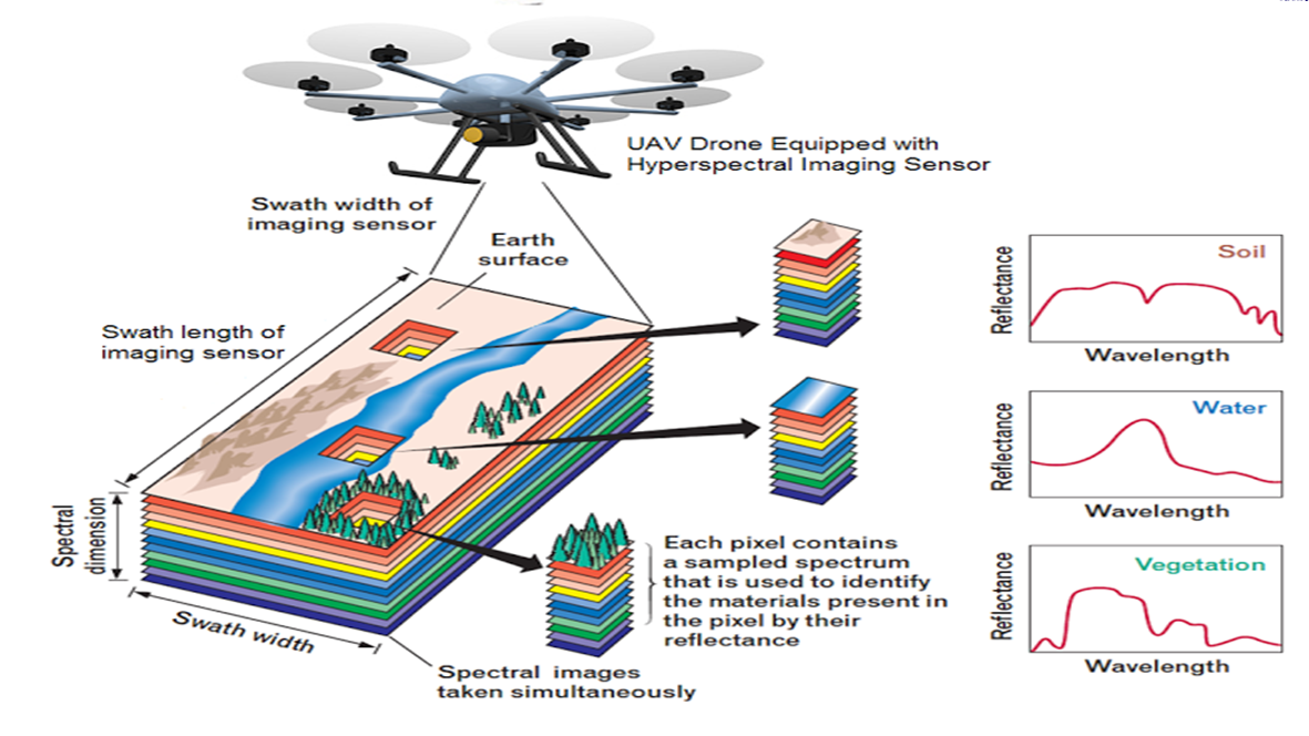
Nihon Communication Solution proposes a Drone based imaging system. In this system, an advanced Hyperspectral imaging Spectro Radio Meter camera is mounted on a professional Drone. The Spectro Radio Meter will be capturing images, with greatly improved characterization of the land.
The land map will be created and Drone will automatically create a flight path suitable to sweep the land. Given the need to have greater predictability by software, it is necessary to have overlapped images, so that the software can stitch the images together, with less errors. So, we propose to have a15 minute flight to cover 20 acres of land run per one battery charge, with approx. 70% overlap. The Drone makes regular areal trips along a given path.
Precision agriculture is based on observing, measuring and responding to inter and intra-field variability in crops. The goal of precision agriculture research is to define a decision support system (DSS) for whole farm management with the goal of optimizing returns on inputs while preserving resources.

One of the main uses of land characterization is to implement Prescriptive farming.
By capturing images at different wavelengths, the farm land can be characterized that
- Identifies vegetation
- Discriminates oil on surface from water
- Differentiates vegetation
- Detects camouflage
- Determines moisture content
- Detects plumes
- Detects explosions
- Identifies Minerals.
